County Londonderry Ireland
Antique Map - 1837
Free county Londonderry map - this map can be copied from this page for free, it is 1500px along the longest edge. For a larger map to print out in fine detail at up to A4 size, please visit our partners at Etsy for a downloadable file.
![]()
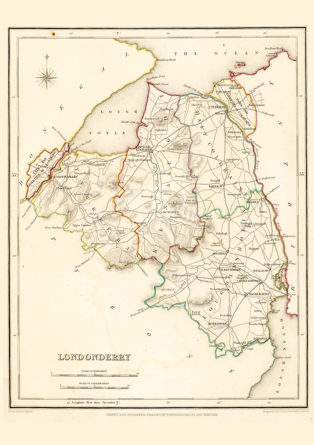
Taken from: "Lewis's Atlas,
comprising the Counties of Ireland"
Published
in London by S. Lewis & Co. 87 Aldersgate Street 27th of
September 1837.
These maps are especially useful in genealogy as they were published in 1837, just 10 years before the disaster of the "Great Famine" in 1847. This was a time when the population size was at a historical high and just prior to the peak of Irish emigration as a result of the famine. The population of many places on the maps dropped rapidly in the following 20 years with some becoming uninhabited..
These maps are high resolution digital scans of the originals, the printed detail is greater than reproduced on this web site.
Original map image size is approx. 200 x 250mm
![]()
Buy a downloadable file of this map.
A high resolution digital scan of an original. These picture
files can be printed out at up to A4 size to give high quality
decorative prints for mounting and display.
The size
and quality are optimized at 300dpi and 297mm x 210mm for a
full size print which will fit in readily available standard
A4 picture frames.
For personal use only, not for resale or commercial use.
Places marked include:
Districts - City and Liberties of Londonderry, Tyrkeeran, Kenaught, Half Coleraine, Loughinshalin
Town, Villages, Settlements:
Aghadowey
Aghanloo
Agivey
Antrea
Arboe
Ballinderny
Ballyaghran
Ballykelly
Ballymoney
Ballynascreen
Ballynashane
Ballyronan
Ballyscullion
Ballywillin
Balteagh
Banagher
Bellaghy
Benyevenagh
Boghillreay
Bovenagh
Carntaghev
Castle-Dawson
Clady
Claudy
Clondermot
Coagh
Coleraine
Derryloran
Desertlyn
Desertmartin
Desertogill
Donalds-Hill
Draperstown
Drumachase
Dunboe
Dungiven
Errigall
Faugharvale
Garvagh
Gracefield
Innisrush
Kilcronaghan
Killdollagh
Killelagh
Killowen
Killrea
Learmount
Legavarron
Lower-Cumber
Macosquin
Maghera
Magherafelt
Magilligan
Mantello-Tower
Moneymore
Newtown-Limavady
Portstemant
Tamlaght
Tamlaght-Finlagan
Tamlaght O'Crilly
Templemore
Templemoyle
Termoneeny
Tubbermore
Upper-Cumber
Woods-Chapel


