County Armagh Ireland, Antique Map - 1837
Free county Armagh map - this map can be copied from this page for free, it is about 1500px along the longest edge.
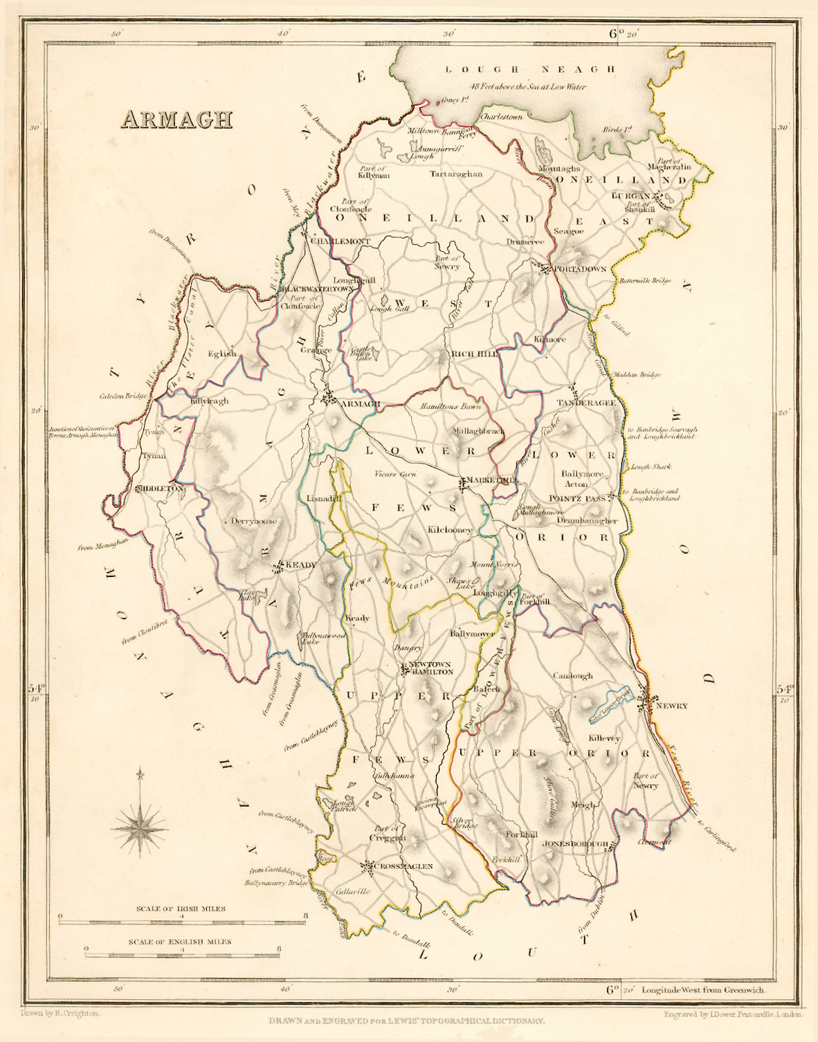
Taken from: "Lewis's Atlas,
comprising the Counties of Ireland"
Published
in London by S. Lewis & Co. 87 Aldersgate Street 27th of
September 1837.
These maps are especially useful in genealogy as they were published in 1837, just 10 years before the disaster of the "Great Famine" in 1847. This was a time when the population size was at a historical high and just prior to the peak of Irish emigration as a result of the famine. The population of many places on the maps dropped rapidly in the following 20 years with some becoming uninhabited..
Original map image size is approx. 200 x 250mm
No higher resolution image available. Unfortunately I don't have a high enough resolution scan to be able to offer this map as a digital download good enough to be printed out at A4 size. However if it of use to you, please feel free to copy the image on this page which is about 1500px along the longest edge, many place names are readable at this resolution though it comes out rather crudely when printed.
For personal use only, not for resale or commercial use.


