County Antrim Ireland
Antique Map - 1837
Free county Antrim map - this map can be copied from this page for free, it is 1500px along the longest edge. For a larger map to print out in fine detail at up to A4 size, please visit our partners at Etsy for a downloadable file.
![]()
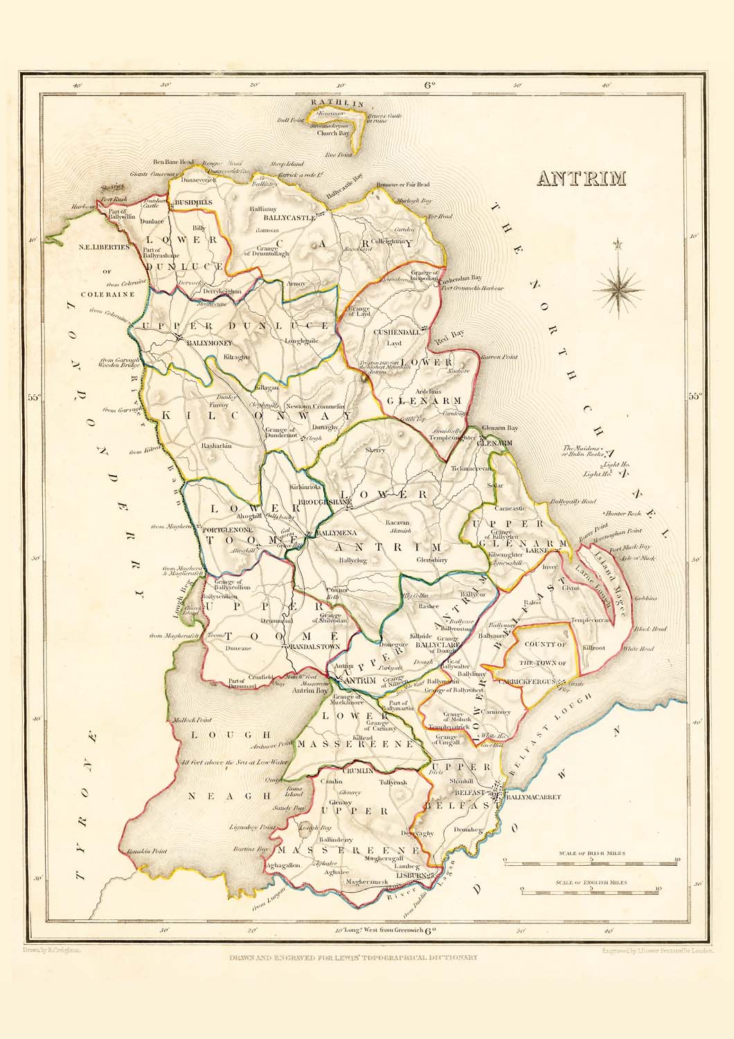
Taken from: "Lewis's Atlas,
comprising the Counties of Ireland"
Published
in London by S. Lewis & Co. 87 Aldersgate Street 27th of
September 1837.
These maps are especially useful in genealogy as they were published in 1837, just 10 years before the disaster of the "Great Famine" in 1847. This was a time when the population size was at a historical high and just prior to the peak of Irish emigration as a result of the famine. The population of many places on the maps dropped rapidly in the following 20 years with some becoming uninhabited..
These maps are high resolution digital scans of the originals, the printed detail is greater than reproduced on this web site.
Original map image size is approx. 200 x 250mm
![]()
Buy a downloadable file of this map.
A high resolution digital scan of an original. These picture
files can be printed out at up to A4 size to give high
quality decorative prints for mounting and display.
The size and quality are optimized at 300dpi and 297mm x
210mm for a full size print which will fit in readily
available standard A4 picture frames.
For personal use only, not for resale or commercial use.
Places marked in county Antrim include:
Districts:
Lower Antrim, Upper
Antrim, Lower Dunluce, Upper Dunluce, Cary, Kilconway, Lower
Toome, Upper Toome, Lower Glenarm, Upper Glenarm, Lower Belfast,
Upper Belfast, Lower Massereene, Upper Massereene
Town, Villages, Settlements:
Aghagallon
Aghalee
Ahaghill
Antrim
Armoy
Ballinderry
Ballintoy
Ballveaston
Ballycastle
Ballyclare
Ballyclug
Ballycor
Ballylinny
Ballymacarret
Ballymartin
Ballymena
Ballymillen
Ballymoney
Ballynabert
Ballynure
Ballyscullion
Ballywalter
Belfast
Broghshane
Bushmills
Carncastle
Carnioney
Carnlogh
Carrickfergus
Ceillybacky
Clogh
Cloghmills
Cormavy
Cornor
Cransfield
Crumlin
Culfeightrin
Cushendell
Derrykighan
Dervaghy
Doagh
Donegore
Drumbeg
Drummaul
Dunaghy
Duneane
Dunley
Dunluce
Finroy
Glenarm
Glenavy
Glenwhirny
Inispollen
Killagan
Killead
Kilroot
Kilwaughter
Kirkinriola
Larne
Lisburn
Magheramesk
Molusk
Mucknamore
Newtown Crommelin
Portglenone
Raloo
Randlestown
Rashee
Rocanan
Shankill
Skerny
Slemish
Solar
Straidkelly
Templecornan
Templeoughter
Templepatrick


