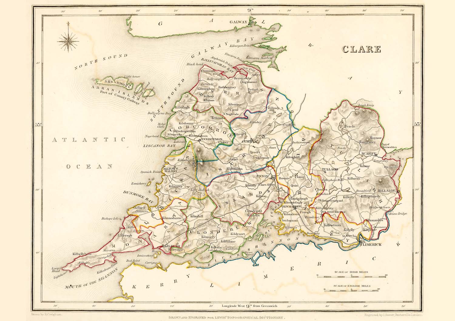
County Clare Ireland
Antique Map - 1837
Free county Clare map - this map can be copied from this page for free, it is 1500px along the longest edge. For a larger map to print out in fine detail at up to A4 size, please visit our partners at Etsy for a downloadable file.

Taken from: "Lewis's Atlas,
comprising the Counties of Ireland"
Published
in London by S. Lewis & Co. 87 Aldersgate Street 27th of
September 1837.
These maps are especially useful in genealogy as they were published in 1837, just 10 years before the disaster of the "Great Famine" in 1847. This was a time when the population size was at a historical high and just prior to the peak of Irish emigration as a result of the famine. The population of many places on the maps dropped rapidly in the following 20 years with some becoming uninhabited..
These maps are high resolution digital scans of the originals, the printed detail is greater than reproduced on this web site.
Original map image size is approx. 200 x 250mm
Buy a downloadable file of this map.
A high resolution digital scan of an original. These picture
files can be printed out at up to A4 size to give high
quality decorative prints for mounting and display.
The size and quality are optimized at 300dpi and 297mm x
210mm for a full size print which will fit in readily
available standard A4 picture frames.
For personal use only, not for resale or commercial use.
Places marked include:
Districts:
Ards, Lower
Castlereagh, Upper Castlereagh, Lower Iveagh, Upper Iveagh,
Kinelarty, Lecale, Mourne
Town, Villages, Settlements:
Aghaderg
Annahilt
Annalong
Ardglass
Ardguin
Ardkeen
Ardmillan
Arnaclone
Ballee
Ballyculter
Ballyhalbert
Ballykindler
Ballymacarret
Ballynahinch
Ballyphilip
Bangor
Barbridge
Belfast
Blaris
Bright
Bryansford
Carlingford
Castlewellan
Clonallan
Clonduff
Clough
Comber
Crawfordsburn
Donaghadeev
Donagheloney
Donaghmore
Down
Downpatrick
Dromara
Dromore
Drumballyroney
Drumbo
Drumgath
Drumgooland
Dundonald
Dundrum
Dunsfort
Garvaghy
Gilford
Grey-Point
Hillsborough
Hilltown
Hollywood
Inch
Kilbroney
Kilkeel
Killaney
Killinchy
Killough
Killyleagh
Kilmegan
Kilmore
Kirkubbin
Knockbreda
Lisburn
Loughbrickland
Loughinisland
Lungan
Maghera
Magheralin
Magherally
Moira
Newry
Newtown Ards
Newtownbreda
Pointz-Pass
Portaferry
Rathfriland
Ringford-Point
Rosstrevon
Saintfield
Seapatrick
Slanes
St. Andrews
Strangford
Strangsford
Lough Tullylish
Tullynakill
Tyrella
Waringstown
Warrenspoint
Other items with this map
|
County Clare Map Standard Mug |
County Clare Map Large Mug |
County Clare Map Flask |
|
County Clare Map Rectangle Magnet |
County Clare Map Greeting Card |
County Clare Map Greeting Cards (pk Of 10) |


