Kings County / County Offaly Ireland
Antique Map1837
Free county Kings County / County Offaly map - this map can be copied from this page for free, it is 1500px along the longest edge. For a larger map to print out in fine detail at up to A4 size, please visit our partners at Etsy for a downloadable file.
![]()
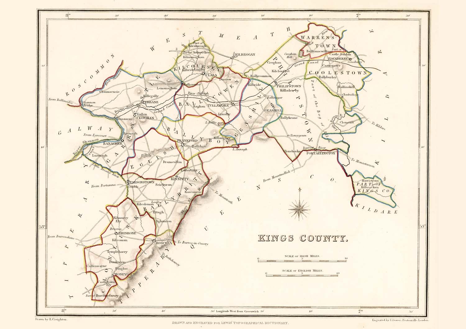
Taken from: "Lewis's Atlas,
comprising the Counties of Ireland"
Published
in London by S. Lewis & Co. 87 Aldersgate Street 27th of
September 1837.
These maps are especially useful in genealogy as they were published in 1837, just 10 years before the disaster of the "Great Famine" in 1847. This was a time when the population size was at a historical high and just prior to the peak of Irish emigration as a result of the famine. The population of many places on the maps dropped rapidly in the following 20 years with some becoming uninhabited..
These maps are high resolution digital scans of the originals, the printed detail is greater than reproduced on this web site.
Original map image size is approx. 200 x 250mm
![]()
Buy a downloadable file of this map.
A high resolution digital scan of an original. These picture
files can be printed out at up to A4 size to give high
quality decorative prints for mounting and display.
The size and quality are optimized at 300dpi and 297mm x
210mm for a full size print which will fit in readily
available standard A4 picture frames.
For personal use only, not for resale or commercial use.


