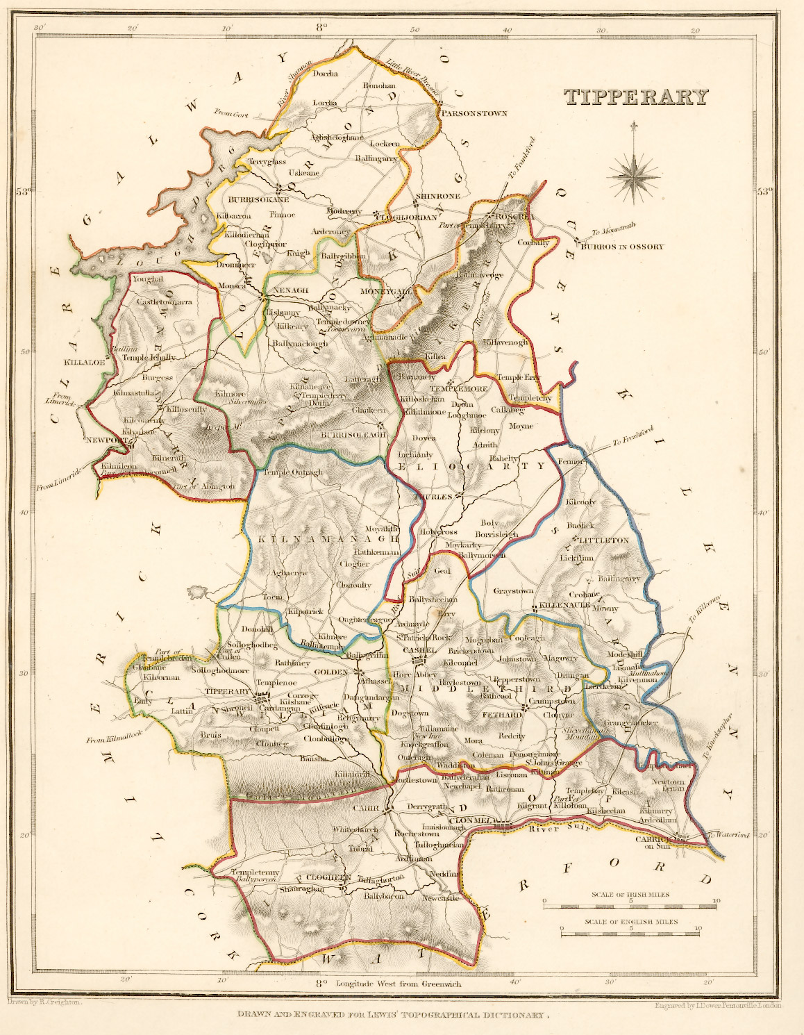
County Tipperary Ireland - Antique Map - 1837
Sorry - This map is not available for sale at larger sizes, please see alternative items further down the page.
Taken from: "Lewis's Atlas, comprising
the Counties of Ireland"
Published in London by
S. Lewis & Co. 87 Aldersgate Street 27th of September 1837.
Original map image size is approx. 200 x 250mm
Actual maps and other printed items do not have the MapsPictures.com watermark
This map was made in 1837, just 10 years before the disaster of the "Great Famine" in 1847. 1837 is a particularly significant time in Ireland's history at the period of the historically highest population and immediately prior to the great exodus of Ireland's population - mainly to the USA, the UK, Canada or Australia.
County Tipperary statistics| Area (km² ) | Population 1841 | Density per km² 1841 | Population 2016 | Density per km² 2016 |
| 4,303 | 435,553 | 101 | 159,553 | 37.2 |
Change 1841 to 2016: 276,000 / 63.4% - decrease


